


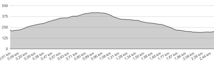
LENGTH: 2,5 km |
LOWEST POINT: 191 m |
HIGHEST POINT: 414 m |
TRACK TYPE: asphalt, forest road |
PARKING: public parking lot at the elementary school in Celjska street |
START/END POINT: at the old museum, the Vilibald Sluga Promenade |
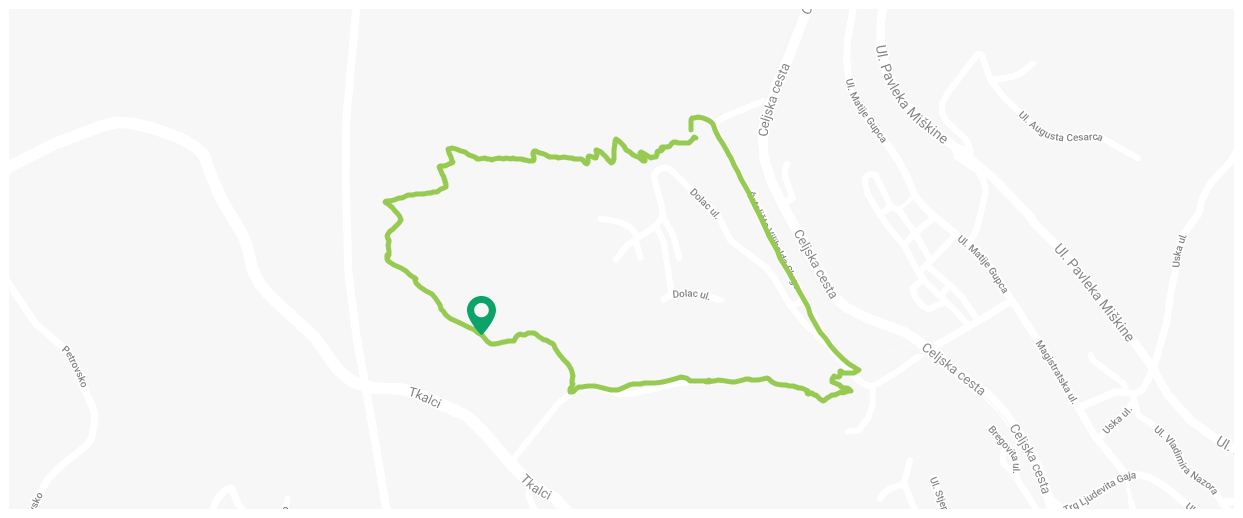
The Hušnjakovo circular trail, Krapina
Technical description
- Start point at the old museum, then heading towards the lake of Dolac, following the signposts
- At the lake, there is a geological pillar to the right and children’s slide and time machine to the left. We continue up the hill to the route marked with hiking and route signs
- 550 m – from the start we come to the wooden “Cave with a view” and continue following the hiking and route signs
- 800 m – Chapel of St. Three Kings, the highest point of the route, arrival to the board. We continue to the south, descending down the forest path to the board “Respecting life, burying the dead”, after which we come to the meadow, keep to the left, walking along the edge of the forest, following the route signs and signposts
- 1150 m – entering the woods, crossing, we turn right towards the asphalt road
- 1200 m – leaving the woods, reaching the asphalt road, T crossing, turning sharply to the left, following the route signs and signposts
- 1400 m – end of asphalt road, we continue down the macadam by the orchard
- 1500 m – arrival to the info board “Technology of the Past Times”. We continue descending down a narrow forest path, arrival to the finding site of Hušnjakovo
- 1800 m – reaching the asphalt road, the Vilibald Sluga Promenade street and arrival to the end point, the old museum