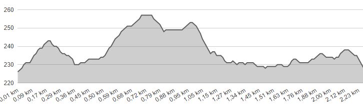
LENGTH: 2,3 km |
LOWEST POINT: 225 m |
HIGHEST POINT: 258 m |
TRACK TYPE: asphalt, macadam, forest path |
PARKING: in front of the Community center |
START/END POINT: Donje Jesenje, downtown, in front of the Community center |
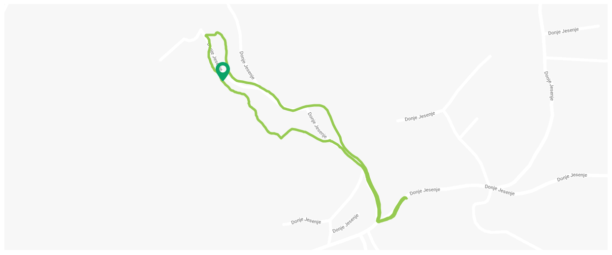
Hunting trails of the Krapina neanderthals
Technical description
- Start/finish
- Heading towards west up the hill and down the sidewalk
- 70 m – shop to the left
- 140 m – crossing, turn sharply to the right from the main road
- 300 m – street crossing, head straight ahead down the asphalted road
- 430 m – Y crossing – turn left to the macadam from the asphalted road
- 460 m – Y crossing – turn left to the forest path, follow the signs on the trees and info posts
- 800 m – resting place, wooden benches
- 1000 m – leaving the woods, keep to the right side of the meadow
- 1100 m – turn sharply to the right, cross over the path towards the wooden bridge above the stream
- 1150 m – wooden bridge above the stream, follow to the right along the stream down the macadam
- 1400 m – arrival to the asphalted road, keep walking to the right. The road leads us to the starting point in front of the Community center